Contents
Logan Pass | Introduction
Logan Pass is one of the most popular and crowded spots in Glacier National Park. Located at the highest point accessible by car within the park, Logan Pass offers breathtaking scenery and abundant wildlife viewing opportunities. Although it is only open during the summer, it is always bustling with visitors when it is accessible. Logan Pass typically opens from late June to mid-October, depending on snowmelt conditions. Therefore, it is advisable to check the official website for opening status if you plan to visit in late June or early October.
Transportation
To reach Logan Pass, you must travel along the Going-to-the-Sun (GTTS) Road, which runs through the heart of the park. In early summer, the GTTS Road may not be fully open to vehicles but may be accessible for walking or biking, making biking up to Logan Pass a very popular activity.
We visited in August when the GTTS Road was fully open. At this time, you can choose to drive or take the shuttle. Driving from the Apgar Visitor Center in the park's west half takes about 1.5 to 2 hours, while driving from the St. Mary Visitor Center takes about 1 hour. If driving to Logan Pass, it is best to arrive before 8 AM, as parking spaces are scarce, and arriving later means you may need to wait. The park may also close the parking lot entrance to control the flow of visitors.
If your destination is solely Logan Pass, taking the shuttle is more convenient. From the Apgar Visitor Center on the west side, you need to transfer at Avalanche Creek. From the St. Mary Visitor Center on the east side, you need to transfer at Sun Point. The road to Logan Pass is steep and winding, so only small buses can make the trip. There may be long lines for the shuttle, requiring a wait for the next bus. If you plan to stay at Logan Pass for an extended period, keep an eye on the shuttle schedule.
![Glacier National Park] Logan Pass and Going-to-the-sun road (GTTS): A Guide to the Best Driving Routes in the U.S. 1 Logan Pass, Going-to-the-sun road 1](https://blog.travelhackfun.com/wp-content/uploads/2021/09/batch_2021-07-17-12-54-52-1.jpg)
![Glacier National Park] Logan Pass and Going-to-the-sun road (GTTS): A Guide to the Best Driving Routes in the U.S. 2 Logan Pass, Going-to-the-sun road 2](https://blog.travelhackfun.com/wp-content/uploads/2021/09/batch_2021-07-17-10-18-20.jpg)
Logan Pass Visitor Center
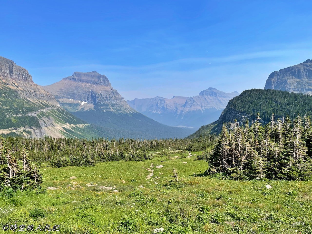
The Logan Pass parking lot is right in front of the visitor center. Stepping out of the car, you immediately feel the chill due to the high elevation. From the visitor center, you can access two main trails: Hidden Lake Trail and Highline Trail. Even from the parking lot, you can enjoy spectacular views. The visitor center displays the flags of the United States and Canada because Glacier National Park and Canada's Waterton Lakes National Park jointly form the Waterton-Glacier International Peace Park.
![Glacier National Park] Logan Pass and Going-to-the-sun road (GTTS): A guide to the best driving routes in the U.S. 3 Logan Pass, Going-to-the-sun road 3](https://blog.travelhackfun.com/wp-content/uploads/2021/09/batch_2021-07-17-13-47-31.jpg)
![Glacier National Park] Logan Pass and Going-to-the-sun road (GTTS): A guide to the best driving routes in the U.S. 4 Logan pass](https://blog.travelhackfun.com/wp-content/uploads/2021/09/batch_2021-07-17-16-04-04.jpg)
![Glacier National Park] Logan Pass and Going-to-the-sun road (GTTS): A guide to the best driving routes in the U.S. 5 Logan Pass, Going-to-the-sun road 4](https://blog.travelhackfun.com/wp-content/uploads/2021/09/batch_2021-07-22-16-49-51.jpg)

Going-to-the-sun road: America's Best Driving Routes
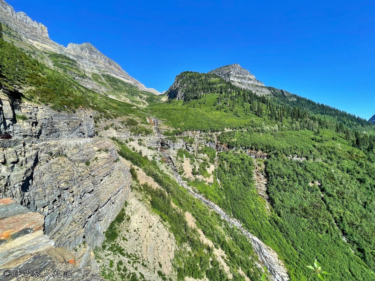
As mentioned, to reach Logan Pass, you must travel along the Going-to-the-Sun Road. This 50-mile-long road cuts through the heart of Glacier National Park. The GTTS Road, known for its decade-long challenging construction, is one of the few roads to receive the honors of National Historic Landmark, National Civil Engineering Landmark, and National Historic District. The road's stunning scenery makes it an incredibly popular attraction, often said to be even more famous than Logan Pass. Whether driving or biking, a visit to Glacier National Park is incomplete without traveling the GTTS Road.
Driving along this road and taking in the breathtaking views is an essential part of the Logan Pass experience. Heading east after crossing Avalanche Creek, you can see various natural landscapes, including valleys, waterfalls, creeks, and glaciers.
![Glacier National Park] Logan Pass and Going-to-the-sun road (GTTS): A Guide to the Best Driving Routes in the U.S. 7 Logan Pass, Going-to-the-sun road 6](https://blog.travelhackfun.com/wp-content/uploads/2021/09/batch_2021-07-17-13-38-57.jpg)

![Glacier National Park] Logan Pass and Going-to-the-sun road (GTTS): A guide to the best driving routes in the U.S. 9 Logan Pass, Going-to-the-sun road 8](https://blog.travelhackfun.com/wp-content/uploads/2021/09/batch_2021-07-22-16-22-46.jpg)
![Glacier National Park] Logan Pass and Going-to-the-sun road (GTTS): A Guide to the Best Driving Routes in the U.S. 10 Logan Pass, Going-to-the-sun road 9](https://blog.travelhackfun.com/wp-content/uploads/2021/09/batch_2021-07-22-16-27-23.jpg)
![Glacier National Park] Logan Pass and Going-to-the-sun road (GTTS): A guide to the best driving routes in the U.S. 11 Logan Pass, Going-to-the-sun road 10](https://blog.travelhackfun.com/wp-content/uploads/2021/09/batch_2021-07-22-16-29-38.jpg)
![Glacier National Park] Logan Pass and Going-to-the-sun road (GTTS): A guide to the best driving routes in the U.S. 12 Logan Pass, Going-to-the-sun road 11](https://blog.travelhackfun.com/wp-content/uploads/2021/09/batch_2021-07-22-16-53-16.jpg)
![Glacier National Park] Logan Pass and Going-to-the-sun road (GTTS): A guide to the best driving routes in the U.S. 13 Going-to-the-sun road (GTTS)](https://blog.travelhackfun.com/wp-content/uploads/2021/09/batch_2021-07-22-16-54-05.jpg)
![Glacier National Park] Logan Pass and Going-to-the-sun road (GTTS): A guide to the best driving routes in the U.S. 14 Logan Pass, Going-to-the-sun road 12](https://blog.travelhackfun.com/wp-content/uploads/2021/09/batch_2021-07-22-16-56-09.jpg)
![Glacier National Park] Logan Pass and Going-to-the-sun road (GTTS): A guide to the best driving routes in the U.S. 15 Logan Pass, Going-to-the-sun road 13](https://blog.travelhackfun.com/wp-content/uploads/2021/09/batch_2021-07-22-16-58-24.jpg)
![Glacier National Park] Logan Pass and Going-to-the-sun road (GTTS): A guide to the best driving routes in the U.S. 16 Logan Pass, Going-to-the-sun road 14](https://blog.travelhackfun.com/wp-content/uploads/2021/09/batch_2021-07-22-17-04-29.jpg)
![Glacier National Park] Logan Pass and Going-to-the-sun road (GTTS): A guide to the best driving routes in the U.S. 17 Logan Pass, Going-to-the-sun road 15](https://blog.travelhackfun.com/wp-content/uploads/2021/09/batch_2021-07-22-17-09-15.jpg)
![Glacier National Park] Logan Pass and Going-to-the-sun road (GTTS): A guide to the best driving routes in the U.S. 18 Logan Pass, Going-to-the-sun road 16](https://blog.travelhackfun.com/wp-content/uploads/2021/09/batch_2021-07-22-17-33-40.jpg)
![Glacier National Park] Logan Pass and Going-to-the-sun road (GTTS): A guide to the best driving routes in the U.S. 19 Logan Pass, Going-to-the-sun road 17](https://blog.travelhackfun.com/wp-content/uploads/2021/09/batch_2021-07-22-17-11-17.jpg)
![Glacier National Park] Logan Pass and Going-to-the-sun road (GTTS): A guide to the best driving routes in the U.S. 20 Logan Pass, Going-to-the-sun road 18](https://blog.travelhackfun.com/wp-content/uploads/2021/09/batch_2021-07-22-16-59-09.jpg)
![Glacier National Park] Logan Pass and Going-to-the-sun road (GTTS): A guide to the best driving routes in the U.S. 21 Logan Pass, Going-to-the-sun road 19](https://blog.travelhackfun.com/wp-content/uploads/2021/09/batch_2021-07-22-16-35-37.jpg)
![Glacier National Park] Logan Pass and Going-to-the-sun road (GTTS): A guide to the best driving routes in the U.S. 22 Logan Pass, Going-to-the-sun road 20](https://blog.travelhackfun.com/wp-content/uploads/2021/09/batch_2021-07-22-16-35-50.jpg)
- Hotel search: Agoda
- Activities & tickets: KKday / Klook / TripAdvisor
- Travel credit cards (US only): My card picks + beginner tips
Logan Pass | Recommended Trails
Hidden Lake Trail
The Hidden Lake Trailhead is located just behind the visitor center. If you walk to the Hidden Lake Overlook, it's 1.4 miles each way, making a round trip of nearly 3 miles. The trail starts by passing through a meadow with boardwalks, making it very easy to walk. When we visited, some wildflowers were still blooming in the meadow, making it exceptionally beautiful. To the right of the trail is Clements Mountain, ahead is Bearhat Mountain, and to the left is Reynolds Mountain, all of which are pyramidal peaks formed by glacial erosion.
![Glacier National Park] Logan Pass and Going-to-the-sun road (GTTS): A guide to the best driving routes in the U.S. 23 Logan Pass, Going-to-the-sun road 21](https://blog.travelhackfun.com/wp-content/uploads/2021/09/batch_2021-07-17-13-50-48.jpg)
![Glacier National Park] Logan Pass and Going-to-the-sun road (GTTS): A guide to the best driving routes in the U.S. 24 Logan Pass, Going-to-the-sun road 22](https://blog.travelhackfun.com/wp-content/uploads/2021/09/batch_2021-07-17-13-51-58.jpg)
![Glacier National Park] Logan Pass and Going-to-the-sun road (GTTS): A guide to the best driving routes in the U.S. 25 Logan Pass, Going-to-the-sun road 23](https://blog.travelhackfun.com/wp-content/uploads/2021/09/batch_2021-07-17-13-57-48.jpg)
![Glacier National Park] Logan Pass and Going-to-the-sun road (GTTS): A guide to the best driving routes in the U.S. 26 Logan Pass, Going-to-the-sun road 24](https://blog.travelhackfun.com/wp-content/uploads/2021/09/batch_2021-07-17-14-00-19.jpg)
![Glacier National Park] Logan Pass and Going-to-the-sun road (GTTS): A guide to the best driving routes in the U.S. 27 Logan Pass, Going-to-the-sun road 25](https://blog.travelhackfun.com/wp-content/uploads/2021/09/batch_2021-07-17-14-06-53.jpg)
![Glacier National Park] Logan Pass and Going-to-the-sun road (GTTS): A guide to the best driving routes in the U.S. 28 Logan Pass, Going-to-the-sun road 26](https://blog.travelhackfun.com/wp-content/uploads/2021/09/batch_2021-07-17-14-12-30.jpg)
After the boardwalk ends, the trail becomes a climb. When we visited, most of the snow had melted, making it relatively easy to walk. However, some snow and small waterfalls formed by snowmelt were still visible along the way. We saw many wild animals here, including antelopes and bighorn sheep.
![Glacier National Park] Logan Pass and Going-to-the-sun road (GTTS): A guide to the best driving routes in the U.S. 29 Logan Pass, Going-to-the-sun road 27](https://blog.travelhackfun.com/wp-content/uploads/2021/09/batch_2021-07-17-14-23-43.jpg)
![Glacier National Park] Logan Pass and Going-to-the-sun road (GTTS): A guide to the best driving routes in the U.S. 30 Logan Pass, Going-to-the-sun road 28](https://blog.travelhackfun.com/wp-content/uploads/2021/09/batch_2021-07-17-15-34-33.jpg)
After 1.5 miles, you reach the Hidden Lake Overlook, offering a stunning view of Hidden Lake nestled against Bearhat Mountain. The trail can continue down to the lakeshore, but when we visited, it was closed due to bears fishing at the lake, so this was our endpoint.
![Glacier National Park] Logan Pass and Going-to-the-sun road (GTTS): A guide to the best driving routes in the U.S. 31 Logan Pass, Going-to-the-sun road 29](https://blog.travelhackfun.com/wp-content/uploads/2021/09/batch_2021-07-17-14-52-27.jpg)
![Glacier National Park] Logan Pass and Going-to-the-sun road (GTTS): A guide to the best driving routes in the U.S. 32 Logan Pass, Going-to-the-sun road 30](https://blog.travelhackfun.com/wp-content/uploads/2021/09/batch_2021-07-17-15-02-29.jpg)
Highline Trail
The Highline Trailhead is located across from the Logan Pass Visitor Center. This is a very long trail. Generally, two routes are recommended: one is to hike to Haystack Butte and return, which is relatively flat but requires a 10-mile round trip. The other option is to connect to The Loop and take the shuttle back to Logan Pass, which is longer and involves a steep descent to The Loop. Most people hike towards Granite Park Chalet and decide when to turn back based on their stamina.
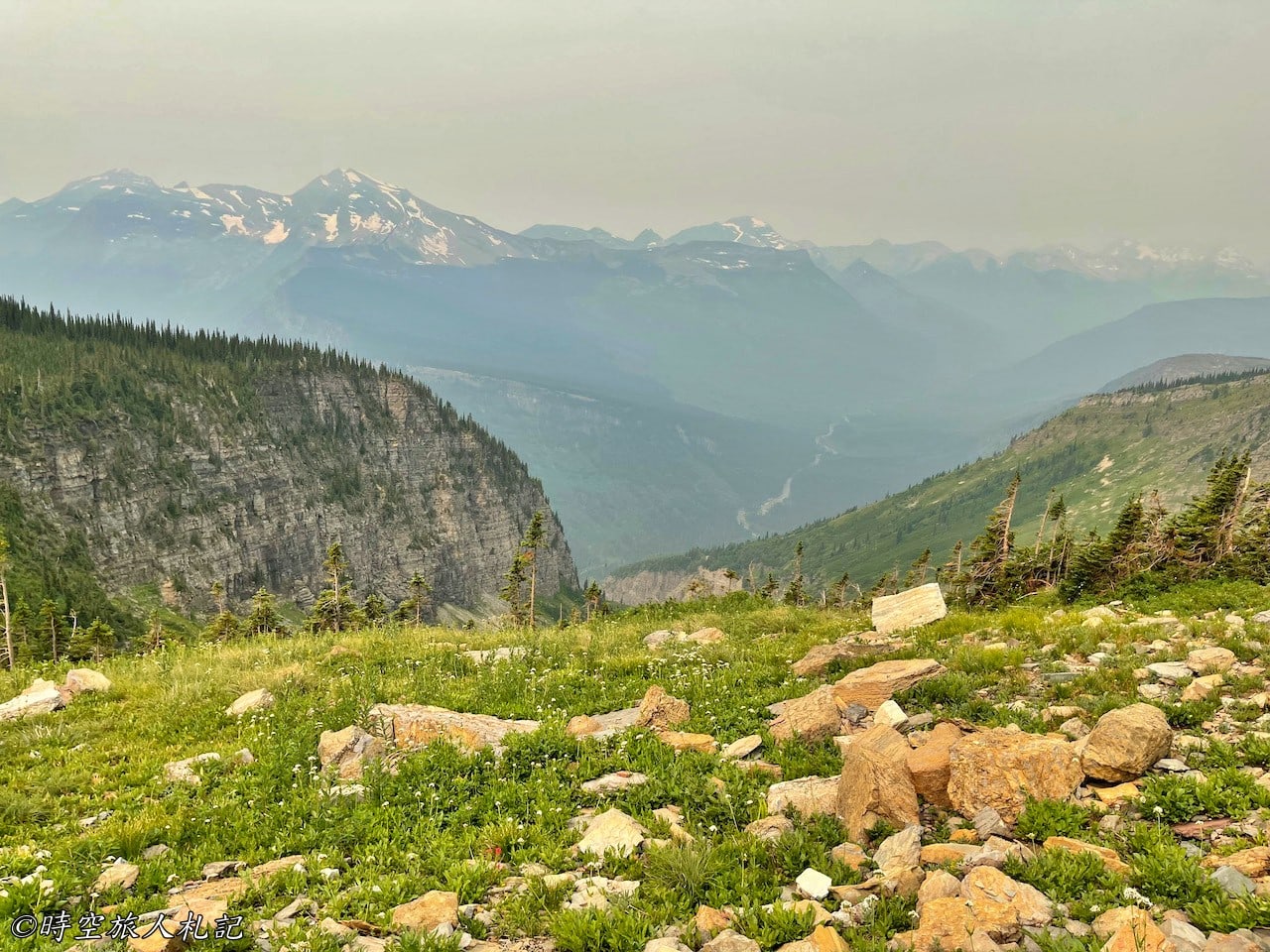
The Highline Trail to Haystack Butte roughly parallels the GTTS Road, running along cliffside ledges. The trail is narrow in some places, with ropes for safety. However, the panoramic views from this higher vantage point are even more spectacular than those from the road. When we hiked the Highline Trail, the smoke from wildfires was heavy, but we could still appreciate the magnificent scenery.
![Glacier National Park] Logan Pass and Going-to-the-sun road (GTTS): A Guide to the Best Driving Routes in the U.S. 33 Logan Pass, Going-to-the-sun road 31](https://blog.travelhackfun.com/wp-content/uploads/2021/09/batch_2021-07-18-08-23-00.jpg)
![Glacier National Park] Logan Pass and Going-to-the-sun road (GTTS): A guide to the best driving routes in the U.S. 34 Logan Pass, Going-to-the-sun road 32](https://blog.travelhackfun.com/wp-content/uploads/2021/09/batch_2021-07-18-08-24-33.jpg)
![Glacier National Park] Logan Pass and Going-to-the-sun road (GTTS): A guide to the best driving routes in the U.S. 35 Logan Pass, Going-to-the-sun road 33](https://blog.travelhackfun.com/wp-content/uploads/2021/09/batch_2021-07-18-08-32-05.jpg)
![Glacier National Park] Logan Pass and Going-to-the-sun road (GTTS): A guide to the best driving routes in the U.S. 36 Logan Pass, Going-to-the-sun road 34](https://blog.travelhackfun.com/wp-content/uploads/2021/09/batch_2021-07-18-08-45-52.jpg)
![Glacier National Park] Logan Pass and Going-to-the-sun road (GTTS): A Guide to the Best Driving Routes in the U.S. 37 Logan Pass, Going-to-the-sun road 35](https://blog.travelhackfun.com/wp-content/uploads/2021/09/batch_2021-07-18-09-00-02.jpg)
![Glacier National Park] Logan Pass and Going-to-the-sun road (GTTS): A guide to the best driving routes in the U.S. 38 Logan Pass, Going-to-the-sun road 36](https://blog.travelhackfun.com/wp-content/uploads/2021/09/batch_2021-07-18-09-28-47.jpg)
![Glacier National Park] Logan Pass and Going-to-the-sun road (GTTS): A guide to the best driving routes in the U.S. 39 Logan Pass, Going-to-the-sun road 37](https://blog.travelhackfun.com/wp-content/uploads/2021/09/batch_2021-07-18-08-41-32.jpg)
![Glacier National Park] Logan Pass and Going-to-the-sun road (GTTS): A Guide to the Best Driving Routes in the U.S. 40 Logan Pass, Going-to-the-sun road 38](https://blog.travelhackfun.com/wp-content/uploads/2021/09/batch_2021-07-18-10-11-36.jpg)
![Glacier National Park] Logan Pass and Going-to-the-sun road (GTTS): A Guide to the Best Driving Routes in the U.S. 41 Logan Pass, Going-to-the-sun road 39](https://blog.travelhackfun.com/wp-content/uploads/2021/09/batch_2021-07-18-09-28-50.jpg)
![Glacier National Park] Logan Pass and Going-to-the-sun road (GTTS): A guide to the best driving routes in the U.S. 42 Logan Pass, Going-to-the-sun road 40](https://blog.travelhackfun.com/wp-content/uploads/2021/09/batch_2021-07-18-09-28-58.jpg)
![Glacier National Park] Logan Pass and Going-to-the-sun road (GTTS): A guide to the best driving routes in the U.S. 43 Logan Pass, Going-to-the-sun road 41](https://blog.travelhackfun.com/wp-content/uploads/2021/09/batch_2021-07-18-09-37-36.jpg)
![Glacier National Park] Logan Pass and Going-to-the-sun road (GTTS): A guide to the best driving routes in the U.S. 44 Logan Pass, Going-to-the-sun road 42](https://blog.travelhackfun.com/wp-content/uploads/2021/09/batch_2021-07-18-09-38-02.jpg)
![Glacier National Park] Logan Pass and Going-to-the-sun road (GTTS): A guide to the best driving routes in the U.S. 45 Logan Pass, Going-to-the-sun road 43](https://blog.travelhackfun.com/wp-content/uploads/2021/09/batch_2021-07-18-10-12-19.jpg)
![Glacier National Park] Logan Pass and Going-to-the-sun road (GTTS): A Guide to the Best Driving Routes in the U.S. 46 Logan Pass, Going-to-the-sun road 44](https://blog.travelhackfun.com/wp-content/uploads/2021/09/batch_2021-07-18-10-12-42.jpg)
![Glacier National Park] Logan Pass and Going-to-the-sun road (GTTS): A guide to the best driving routes in the U.S. 47 Logan Pass, Going-to-the-sun road 45](https://blog.travelhackfun.com/wp-content/uploads/2021/09/batch_2021-07-18-10-45-14.jpg)

![Glacier National Park] Logan Pass and Going-to-the-sun road (GTTS): A guide to the best driving routes in the U.S. 49 Logan Pass, Going-to-the-sun road 47](https://blog.travelhackfun.com/wp-content/uploads/2021/09/batch_2021-07-18-11-26-11.jpg)
![Glacier National Park] Logan Pass and Going-to-the-sun road (GTTS): A guide to the best driving routes in the U.S. 50 Logan Pass, Going-to-the-sun road 48](https://blog.travelhackfun.com/wp-content/uploads/2021/09/batch_2021-07-18-11-47-09.jpg)
![Glacier National Park] Logan Pass and Going-to-the-sun road (GTTS): A guide to the best driving routes in the U.S. 51 Logan Pass, Going-to-the-sun road 49](https://blog.travelhackfun.com/wp-content/uploads/2021/09/batch_2021-07-18-12-01-14.jpg)
![Glacier National Park] Logan Pass and Going-to-the-sun road (GTTS): A guide to the best driving routes in the U.S. 52 Logan Pass, Going-to-the-sun road 50](https://blog.travelhackfun.com/wp-content/uploads/2021/09/batch_2021-07-18-12-08-04.jpg)
![Glacier National Park] Logan Pass and Going-to-the-sun road (GTTS): A guide to the best driving routes in the U.S. 53 Logan Pass, Going-to-the-sun road 51](https://blog.travelhackfun.com/wp-content/uploads/2021/09/batch_2021-07-18-12-32-45.jpg)
![Glacier National Park] Logan Pass and Going-to-the-sun road (GTTS): A guide to the best driving routes in the U.S. 54 Logan Pass, Going-to-the-sun road 52](https://blog.travelhackfun.com/wp-content/uploads/2021/09/batch_2021-07-18-13-34-31.jpg)
![Glacier National Park] Logan Pass and Going-to-the-sun road (GTTS): A guide to the best driving routes in the U.S. 55 Logan Pass, Going-to-the-sun road 53](https://blog.travelhackfun.com/wp-content/uploads/2021/09/batch_2021-07-18-13-15-33.jpg)
![Glacier National Park] Logan Pass and Going-to-the-sun road (GTTS): A guide to the best driving routes in the U.S. 56 Logan Pass, Going-to-the-sun road 54](https://blog.travelhackfun.com/wp-content/uploads/2021/09/batch_2021-07-18-12-20-09.jpg)
![Glacier National Park] Logan Pass and Going-to-the-sun road (GTTS): A Guide to the Best Driving Routes in the U.S. 57 Logan Pass, Going-to-the-sun road 55](https://blog.travelhackfun.com/wp-content/uploads/2021/09/batch_2021-07-18-13-37-50.jpg)
![Glacier National Park] Logan Pass and Going-to-the-sun road (GTTS): A guide to the best driving routes in the U.S. 58 Logan Pass, Going-to-the-sun road 56](https://blog.travelhackfun.com/wp-content/uploads/2021/09/batch_2021-07-18-13-36-39.jpg)
There are also many wild animals on the Highline Trail, and they are not afraid of people, often foraging right next to the trail.
![Glacier National Park] Logan Pass and Going-to-the-sun road (GTTS): A guide to the best driving routes in the U.S. 59 Logan Pass, Going-to-the-sun road 57](https://blog.travelhackfun.com/wp-content/uploads/2021/09/batch_2021-07-18-08-32-59.jpg)
![Glacier National Park] Logan Pass and Going-to-the-sun road (GTTS): A guide to the best driving routes in the U.S. 60 Logan Pass, Going-to-the-sun road 58](https://blog.travelhackfun.com/wp-content/uploads/2021/09/batch_2021-07-18-12-48-12.jpg)
![Glacier National Park] Logan Pass and Going-to-the-sun road (GTTS): A Guide to the Best Driving Routes in the U.S. 61 Logan Pass, Going-to-the-sun road 59](https://blog.travelhackfun.com/wp-content/uploads/2021/09/batch_2021-07-18-12-49-03.jpg)
![Glacier National Park] Logan Pass and Going-to-the-sun road (GTTS): A guide to the best driving routes in the U.S. 62 Logan Pass, Going-to-the-sun road 60](https://blog.travelhackfun.com/wp-content/uploads/2021/09/batch_2021-07-18-12-49-25.jpg)
If you take the Loop Trail, the descent is very steep and hard on the knees. A ranger specifically warned us, saying, "It will kill you."
![Glacier National Park] Logan Pass and Going-to-the-sun road (GTTS): A guide to the best driving routes in the U.S. 63 Logan Pass, Going-to-the-sun road 61](https://blog.travelhackfun.com/wp-content/uploads/2021/09/batch_2021-07-22-17-33-34.jpg)
☕ Enjoying my travel notes?
You can Buy me a coffee to support what I do 🙌
Further reading
- All Glacier National Park posts